Africa · 2 cities
Things to Do in Mauritius
Port Louis and Ile aux Cerfs in one place: which coast to stay on, what the interior holds beyond the beaches, and the months the cyclones come.
765 tours listed by Viator 2 cities we cover Free cancellation







Where to go
Cities of Mauritius
In the order Viator’s own catalogue puts them — most-booked first, not alphabetical.
Full list
All cities, by region
Grouped by region using Viator’s own map of the country. The first block is the places it files directly under Mauritius.


Practical info
Know before you book
The things that change a decision — not a retelling of the guidebook.
Ile aux Cerfs is the standard day out
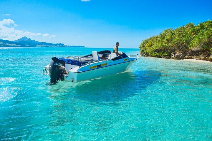
A catamaran from the east coast to a small island with a lagoon, usually with a barbecue lunch and a stop at the Grande Rivière Sud-Est waterfall. It is genuinely beautiful and genuinely busy — the earlier departures see a different island.
The interior is worth a full day
Black River Gorges national park, the Chamarel seven-coloured earth, the waterfall and the tea route make a proper day inland and look nothing like the coast. Most visitors never leave their resort, which is why the interior stays quiet.
The coasts are not interchangeable
The east is windier — good for kitesurfing, less good for flat calm swimming. The north and west are more sheltered and hold the liveliest towns. The south is rugged and has the fewest resorts. Choose by what you want from the water.
The underwater waterfall is an illusion from the air
The famous image at Le Morne is sand and silt moving off a shelf, and it only reads as a waterfall from several hundred metres up. Seeing it means a seaplane or helicopter flight — there is nothing to see from the beach.
Four languages in daily use
English is the official language, French is what most people speak day to day, Creole is the mother tongue and Hindi and Bhojpuri are widely used. Visitors manage entirely in English, and a little French is appreciated.
The resorts and the island have different prices
Hotel food and excursions are priced internationally; eating in a village, taking the bus or hiring a local guide costs a fraction of it. The bus network covers the whole island for very little and is how most Mauritians travel.
When to visit
Mauritius through the seasons
What is open, how busy it gets, and when to book ahead.
Winter
May–Sep
- Best for
- Dry, mild weather, no cyclone risk, the best hiking and diving conditions.
- Crowds
- Booking tip
- The peak season — cooler and windier on the east coast, which suits kitesurfers.
Spring
Oct–Nov
- Best for
- Warming sea, low rainfall, prices before the December peak.
- Crowds
- Booking tip
- Arguably the best value window of the year here.
Cyclone season
Dec–Mar
- Best for
- The warmest sea, lush interior, and the local holiday season.
- Crowds
- Booking tip
- Cyclones are infrequent but real — take the flexible booking in these months.
Autumn
Apr
- Best for
- Sea still warm, humidity dropping, risk easing, prices low.
- Crowds
- Booking tip
- April is the transition month and often the quietest good weather of the year.
Frequently asked
Mauritius: common questions
How many days do you need in Mauritius?
Seven to ten days. That is enough for a catamaran day, a day inland at Chamarel and the gorges, a morning in Port Louis and the rest on a beach. The island is small — nowhere is more than ninety minutes from anywhere else.
What does a tour in Mauritius cost?
Mauritius is not in our fifty-city price index, so we avoid a median figure. Excursions booked through resorts are priced at international levels; the same catamaran or inland tour booked locally generally costs considerably less.
When is the best time to visit?
May to November, and especially September to November for warm sea with no cyclone risk. December to March is hot, humid and inside the cyclone window, which is when prices are lowest.
Which coast should I stay on?
North and west for calm water, sunsets and the most restaurants; east for wind sports and quieter beaches; south for scenery and the fewest crowds. The east is noticeably breezier year round, which is either the point or the problem.
Do you need to hire a car?
Not necessarily. Buses cover the island cheaply and taxis are affordable for day trips. A car gives freedom for the interior, with the caveats of left-hand driving and narrow village roads.