10 min
This is the first stop on Emigrant Canyon Rd, the optional detour toward the Wildrose Charcoal Kilns. There’s not much left of this former processing plant from the early 20th century, but the foundations, empty tanks, and other relics may interest photographers and history buffs.
5 min
The second stop on Emigrant Canyon Rd, this former campground for the Civilian Conservation Corps is a good place to stretch your legs as you make the long drive toward the charcoal kilns. Walk through the remaining campground buildings, located right off the road.
Charcoal Kilns10 min
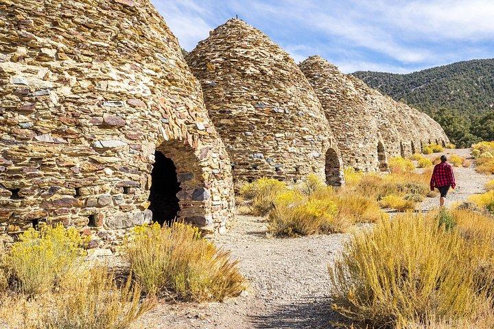
Ten unusual, beehive-shaped charcoal kilns are lined up in a row thousands of feet up in the Panamint Range. Step inside one and you may still get a whiff of that charcoal!
Stovepipe Wells Village30 min
If you plan to eat a meal or buy gasoline within the park, we recommend doing it in Stovepipe Wells, a wayside with visitor services and accommodation.
Mesquite Flat Sand Dunes15 min
The only sand dunes you’ll see on the tour! You can view the dunes from the parking lot, but it’s more fun to explore the dunes on foot and wander among the mesquite trees for some social media-worthy pictures. This is a top pick for sunsets and stargazing, too.
5 min
There’s a peculiar patch of Arrowweed near the Mesquite Flat Sand Dunes that appears like bunches of corn in a field. There’s not much to look at, but a small parking area allows visitors to safely park and get a closer look.
Salt Creek Interpretive Trail15 min
A 0.5-mile boardwalk runs along the Salt Creek wetland, a critical watering hole for critters and home to the endangered Salt Creek Pupfish. The easy trail is down a dirt road.
Harmony Borax Works15 min
Explore what's left of the earliest mining operation in Death Valley. Placards throughout the short path interpret the various buildings and mechanisms required to process borax. You'll also see one of the wagons pulled by the famed 20-mule teams.
5 min
Though there’s no actual stop, you can take a detour into a small canyon with an unusual yellow tinge. Before driving this road, check with the park for the road's current conditions. In normal circumstances, this dirt road is reasonably well-maintained but still bumpy, and not advisable for vehicles with low clearance.
10. Furnace Creek Visitor Center
Furnace Creek Visitor Center30 min
A must-stop for information, flush toilets, a water refill station, and a museum with excellent displays on the natural and human history of Death Valley.
15 min
Furnace Creek is the only place to eat a meal and get gas within the park. Prices are higher here, but you’ll find an ice cream parlor, buffet-style restaurant, and Wild West-themed saloon. There’s also an excellent General Store with souvenirs and a small grocery section. And if you want to know more about the area’s mining history, you can visit the Borax Museum.
Devil's Golf Course10 min
Enjoy the otherworldly shapes of Death Valley’s salt flat, down a short dirt road from Badwater Road. There’s no trail, and you’ll want to make sure you have sturdy shoes if you wander into the ‘golf course.’ That salt can hurt!
30 min
The lowest point in North America, and the highlight of a trip to Death Valley. There's a boardwalk by the parking lot, but you're welcome to wander into the valley on the Badwater Basin trail. Go as far as you'd like into the interior of Death Valley's famed salt flats, but it's about 1 mile in to reach the cool geometric shapes in the salt, making this a 2-mile round trip hike.
30 min
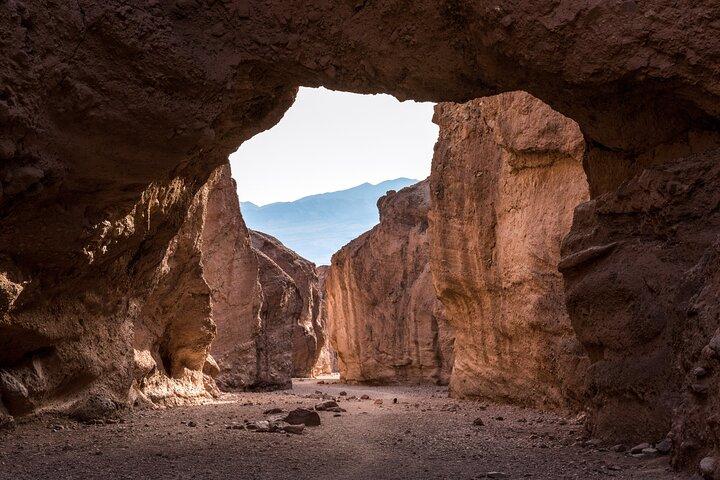
The trail to the natural bridge rock formation is flat, but rocky. It's about 1 mile round-trip from the parking lot to the bridge and back.
Artist's Drive30 min
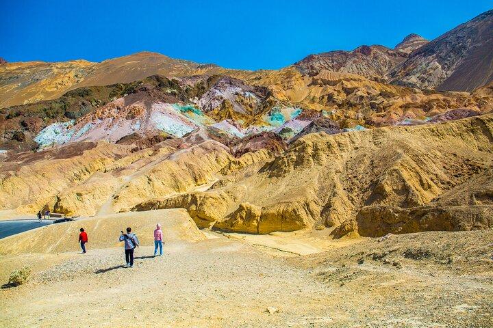
Artists Drive is a one-way road that ascends up toward the Black Mountains into a twisty canyon. The drive itself is fun, as you maneuver through a tight desert landscape. But the highlight is a stop along the road called Artists Palette, where minerals in the rock create a colorful cliff. You can explore on foot for a closer look.
60 min
This is one of the most popular hikes in the park, taking hikers through a lifeless canyon. It's about 3 miles, or 5 kilometers round-trip to the Red Cathedral cliff formation.
Zabriskie Point20 min
One of the most iconic views in the park, overlooking rock formations Red Cathedral and Manly Beacon. This spot is also noted for its film history and its role as the album cover for U2's Joshua Tree. The walk from the parking lot to the overlook is short and paved, but steep.
Twenty Mule Team Canyon15 min
Like Mustard Canyon, this is a dirt road adventure into a tightly curving canyon. And there’s no specific stop, but it’s about a 15-minute detour from the main tour route. Before driving this road, check with the park for the road's current conditions. In normal circumstances, this dirt road is reasonably well-maintained but still bumpy, and not advisable for vehicles with low clearance.
Dante's View30 min
A truly stunning sight to behold. Ascend over 5,000 feet to this overlook directly above Badwater Basin. From here, you’ll see the lowest point in North America with the dramatic Panamint Range looming over it on the other side of the valley. And on clear days, you can see the Sierra Nevada beyond, including Mt. Whitney–the highest point in the lower 48 states. This is a popular sunset and stargazing spot.